Map compilation of Arctic and Antarctic launched in Beijing
2010-01-29 08:39 BJT Mail
Mail Share
Share Print
Print
A compilation of maps of the Arctic and Antarctic continents has hit the shelves in Beijing bookstores. The compilation is evidence of China's scientific achievements in geographic exploration.
The map compilation boasts a prolific portfolio of detailed geographic maps, illustrations and charts of the Arctic and Antarctica.
It features around 150 pictures, evidence of China's achievements in researching the two continents over the past 25 years.
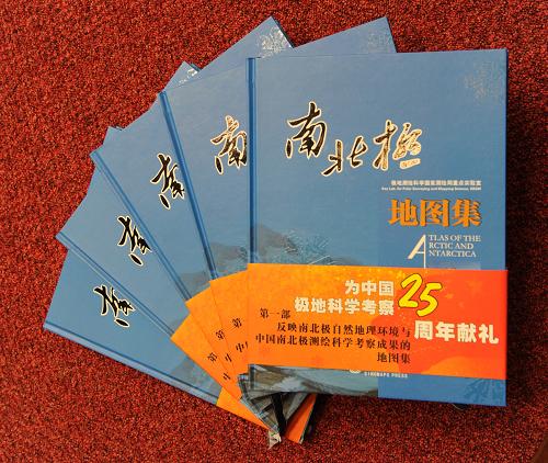 |
| A compilation of maps of the Arctic and Antarctic continents has hit the shelves in Beijing bookstores. The compilation is evidence of China's scientific achievements in geographic exploration. |
The State Bureau of Surveying and Mapping dispatched a total of 111 Chinese researchers to the freezing poles to conduct the cartographic surveying. It covers an area of nearly 200-thousand square meters.
Researchers employed aerial photogrammetry while they travelled.
Such was their dedication, team members fell into ice holes twice, just to ensure the accuracy of the maps.
Related stories


 Video
Video


On CCTV
Get the Channel, CCTV Live, CCTV Live in HD, CCTV-5 (Sports) Live, Latest Video, TV ScheduleCCTV-9 News Programs
Asia Today, Biz China, CCTV News, China This Week, China Today, Culture Express, Dialogue, News Hour, Sports Scene, World Insight, World Wide Watch
Newsletter
RSS
Site Map
|
Contact Us
|
About Us
|
FAQ
|
Jobs
|
Advertise
|
Privacy Policy
|
Terms of Use
 2009 China Central Television. All Rights Reserved